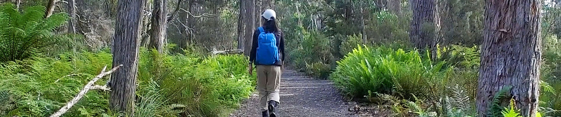
Bushwalking
Watersmeet
45-minute return walk – a well-formed track from the Visitor Centre, Lake St. Clair, mostly level ground suitable for shoes or joggers; most ages.
An easy walk to the junction of the Hugel and Cuvier Rivers, this area is a spectacular sight in winter or a tranquil picture in summer. Collect a leaflet at the start of the track and stop at numbered markers to learn about the areas’ native flora.
Platypus Bay
1-hour return walk – a well-formed track, undulating levels, suitable for shoes or joggers; most ages.
Cross the bridge at Watersmeet and take the track to the right above the Cuvier River to a picturesque bay on Lake St. Clair where (if you are quiet, patient and lucky) you may be rewarded with the sight of a platypus from the hide. The track continues north a short distance and rejoins the Overland Track where you turn left back to Watersmeet.
The Figure of Eight Loop
1-hour-and-30-minute return walk – a well formed track over some small hills; suitable for shoes or joggers; may be too far for very small children. The Larmairremener tabelti, Platypus Bay, and Watersmeet tracks combine to form a figure-of-eight loop walk. Learn about Aboriginal heritage, spot a platypus, and enjoy the bird life and summer wildflower display.
Walk through a wide range of vegetation types as you cross moraine ridges left by retreating glaciers and descend through a luxuriant patch of rainforest on the Shadow Lake track, about 100 metres upstream of the bridge at Watersmeet. Proceed left across the bridge to Platypus Bay or turn right and return to the Visitor Centre at Lake St Clair.
Shadow Lake
3-4-hour return walk – a medium grade walk on a well marked track which climbs 220 metres in 7 km, but can be accomplished by younger children with bushwalking experience and by adults in good health, with moderate fitness levels; walking boots are recommended.
Walk via Watersmeet to an alpine lake beneath Mt. Rufus and Mt. Hugel through towering eucalypts, rainforest trees and snow gums. During November and December you will see bright red flowers of native Waratah bushes which attract honeyeaters and other birds to their sweet nectar. Shadow Lake is surrounded by buttongrass, sedges and groves of pencil pines. Enjoy a picnic near the lake or fish for brown or rainbow trout, if you have a license. Forgotten Lake is an easy 20-minute walk further on.
Shadow Lake Circuit
3-4-hour return walk – a medium grade walk on a well marked track which climbs 220 metres in 7 km, but can be accomplished by younger children with bushwalking experience and by adults in good health, with moderate fitness levels; walking boots are recommended. The circuit can be walked anti-clockwise via Watersmeet or clockwise via the Mt. Rufus track.
Walk through lichen-festooned rainforest, highland yellow gum forest, snow gum woodland and subalpine moorland on this circuit walk to Shadow Lake. Spectacular views of Mt. Rufus, Hugel and Little Hugel are a highlight in clear weather, and the summer wildflower display is magnificent. Platypuses are regularly seen in Shadow Lake.
Mt. Rufus
5-hour return walk – a medium grade walk, which is steep in places during the 680 m climb in the 8 km walk to the summit, suitable for at least moderately fit adults or teenagers; strong boots are recommended. This walk is the direct route from the Visitor Centre to the summit of Mt. Rufus.
This well marked track passes through eucalypt forest, some rainforest gullies on the way, then subalpine snow gum forest before it reaches low alpine plant communities above the treeline. In late spring and early summer the alpine plants provide a colourful display of fragrant flowers. During winter there is often snow suitable for cross-country skiing. The summit of Mt Rufus offers superb views of Frenchmans Cap, Mt. Gell, Mt. Olympus, the King William Range and many other peaks. Return to the Visitor Centre via the same route.
Little Hugel
6-hour return walk – an add-on walk from Forgotten Lake, 20 minutes north of Shadow Lake; wear strong boots and gaiters; the walk to the summit is not recommended for younger children or for anyone when ice or snow affects the rock scree near the summit – seek advice from the Parks Rangers before you depart!
A rewarding extension above Forgotten Lake through pandani, myrtles, deciduous beech and snow gums before the steep cairned route crosses boulders and scree to the summit, which affords panoramic views of Lake St. Clair, Mt. Olympus, Mt. Byron and Mt. Rufus.
Echo Point and return from the Visitor Centre
6-hour-and-30-minute return walk – combine a ferry trip and a rainforest walk on a good track with gentle grades and a picture perfect lakeside hut; suitable for young children as a one way walk returning on the ferry. Flowering leatherwood tress are a summer highlight and the autumn fungi display is colourful and diverse. Whether you walk first then take the ferry or do the reverse, you need to book the ferry. Strong shoes or joggers are suitable.
This is a splendid rainforest walk alongside Lake St. Clair for about three hours. Near Echo Point the track passes through stands of horizontal scrub, an endemic species renowned for producing almost impenetrable thickets of entwined branches. The beach at Echo Point is perfect for lunch with the spectacle of Mt. Ida on the opposite shore; the walkers’ hut provides shelter if the weather is inclement.
Mt. Rufus Circuit
Seven hour walk – with a climb of 680 metres, which is steep in places, but is suitable for adults or teenagers with moderate or good fitness levels. Be careful not to lose the track on Mt. Rufus if the clouds are low.
A memorable circuit walk usually completed clockwise through many vegetation types to a summit and returning past a tranquil lake. Climb to the summit of Mt. Rufus and follow the descending ridgeline north toward Mt. Hugel through Richea Valley below the saddle between Mt. Rufus and Mt. Hugel, and then through rainforest, buttongrass moorlands and snow gum forest to the shores of Shadow Lake. Follow the track from here down to Watersmeet and then back to the Visitor Centre.
Lake Petrarch & return from the Visitor Centre
7-hour return walk – a long day walk up the Cuvier Valley and return, mostly through buttongrass plains, which are often very wet and muddy. Only walk in strong, waterproof boots and gaiters; not suitable for children or unfit adults.
A quite long, strenuous walk to idyllic scenes of pencil pines sheltering crystal clear water and lovely beaches at Lake Petrarch. The Cuvier River which flows from Lake Petrarch to Lake St. Clair contains many small trout and larger trout are often seen in Lake Petrarch. Summer is the best time for this walk because the track may be drier and a dip in the lake is a treat on a hot day.
Echo Point to Narcissus River (or the reverse)
2-hour return walk – an easy walk for children or adults on a gently graded, well marked track. Make sure to book the ferry for transport to and from the walk.
Book your place on the ferry to Echo Point and enjoy an interesting walk through open rainforests and woodlands near the edge of Lake St. Clair. Echo Point and some other sandy beaches are idyllic for lunch, some fishing and a swim in the lake if the weather is warm. You will love the short wilderness experience.
Lake Dixon
1-hour-and 30-minute return walk – an enjoyable, short walk of medium difficulty down to a pretty lake on the Franklin River, with the possibility of some trout fishing and a swim in the river; walking boots are recommended. Suitable for older children and adults.
The track follows a fairly obvious route but has never been formed; you are unlikely to lose your way if you remember to look ahead for the route. Open eucalypt forest fringes the lake at the end of the track but it merges into buttongrass to the north. It is worth taking your fishing rod to try your luck with the brown trout in Lake Dixon and the Franklin River.
Mt. Rufus from the Rufus Canal Track
6-hour return walk – climbs 640 metres over 8 km and requires at least moderate fitness and strong boots, especially during spring or early summer, when some sections of the track can be very wet and muddy. Spectacular views in fine weather, especially to the west.
An alternative route to the summit from the south which passes through eucalypt forests, buttongrass plains, groves of snow gums and alpine herbfields to the summit. Along the track you pass two basic huts - Joe Slater's Hut and Gingerbread Hut, about 100 metres below the summit.
Mt. King William
5-hour return walk – a medium difficulty walk with some very steep track near the summit. Not recommended for children or unfit adults; wear strong walking boots.
Mt. King William provides superb views of many peaks in all directions; during the summer the fire lookout cabin is used to alert fire-fighting crews to wildfires in the South West World Heritage Area.
Franklin River
15-minute return walk – much of this near-level track is on a boardwalk and it has excellent signage discussing what wilderness means to different people. Bring your camera for some magic river-rainforest scenes; suitable for all ages in almost any footwear.
It is a very attractive circuit walk through rainforest along the edge of the Franklin River to its junction with the Surprise River, about 250 metres away. Continue walking alongside this river and follow the track through the rainforest back to its start.
Donaghys Hill Wilderness Lookout Walk
45-minute return walk – a short walk on an all weather track climbing to a lookout offering a spectacular wilderness panorama.
There is a gentle climb through thick forests containing some large eucalypts and beautiful rainforests species. Not to be missed if you have time and the weather is fine. Take your camera and binoculars for superb 360-degree views, especially of the Franklin River and Frenchmans Cap.
Nelson Falls Nature Trail
20-minute return walk – an easy walk for persons of any age and fitness along an excellent track with wheelchair accessibility.
Break your journey for twenty minutes to enjoy an easy walk through temperate rainforest to a charming waterfall in a sylvan setting. The track is almost flat and crosses a delightful creek a number of times on the way to the falls. See if you can spot some small trout in its crystal clear waters.
Bushwalking
| To | Standard | Starts From | kms by road from Chalets | Return Walk kms | Return Walk times. |
|---|---|---|---|---|---|
| Watersmeet | easy | Cynthia Bay | 5 | 3.4 | 45 mins |
| Platypus Bay | easy | Cynthia Bay | 5 | 5.0 | 1 hour |
| Figure of Eight Loop | easy | Cynthia Bay | 5 | 7.5 | 1hr 30 mins |
| Shadow Lake | easy-medium | Cynthia Bay | 5 | 13 | 3-4 hours |
| Shadow Lake Circuit | easy-medium | Cynthia Bay | 5 | 13 | 3-4 hours |
| Mt Rufus | medium | Cynthia Bay | 5 | 15 | 5 hours |
| Little Hugel | medium | Cynthia Bay | 5 | 14 | 6 hours |
| Echo Point | medium | Cynthia Bay | 5 | 22 | 6 hr 30 mins |
| Mt Rufus Circuit | medium | Cynthia Bay | 5 | 18 | 7 hours |
| Lake Petrarch | medium | Cynthia Bay | 5 | 24 | 7 hours |
| Echo Point to Narcissus River | easy | North Lake St Clair | ferry | 9 | 2 hours |
| Lake Dixon | medium | Rufus Canal Road | 13 | 4 | 1 hr 30 mins |
| Mt Rufus (Rufus Canal Track) | medium | Rufus Canal Road | 11 | 16 | 6 hours |
| Mt King William | medium* | Guelph Road | 12 | 9 | 5 hours |
| Franklin River | easy | Lyell Highway | 30 | 0.2 | 15 mins |
| Donaghys Hill | easy | Lyell Highway | 35 | 3 | 45 mins |
| Nelson Falls | easy | Lyell Highway | 62 | 1 | 20 mins |
| *the last section is very steep and is not suitable for children or those in poor health. | |||||